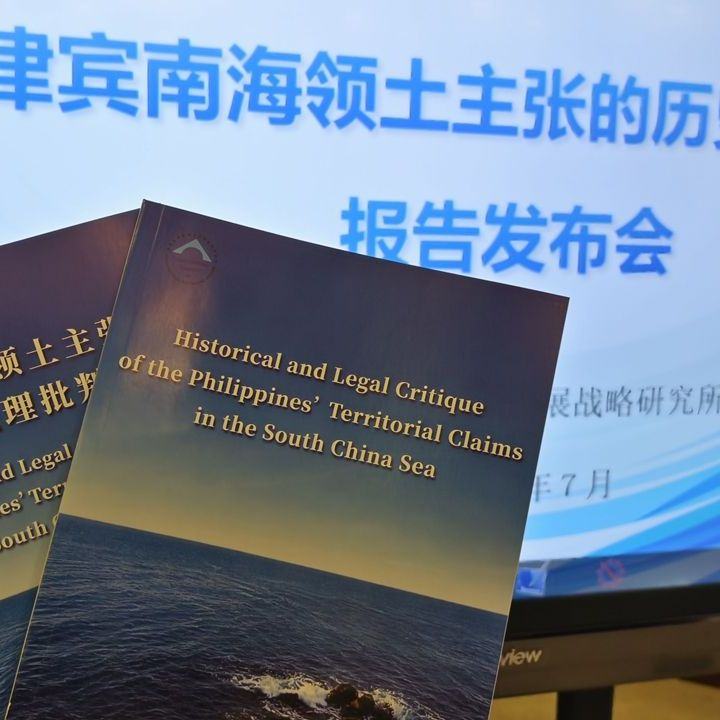
The Chinese Institute for Marine Affairs, under the Ministry of Natural Resources, released a new report on Wednesday that critically assesses the Philippines' territorial claims over Huangyan Dao island and parts of the Nansha Qundao archipelago.
According to the report, Manila's historical and legal arguments are based on misinterpretations of sources, lack substantial legal value, and primarily serve as a pretext for expanding Philippine territory beyond internationally recognized borders. Such unilateral actions, according to the authors, undermine the post-war order and threaten regional stability and the legal framework at sea.
According to the report, since the 1970s, the Philippines has used presidential decrees, constitutional amendments, and other legal instruments to assert claims over parts of the Chinese Nansha Qundao archipelago and Huangyan Dao island. The Chinese side considers this an attempt to exceed the boundaries established by international treaties and expand Philippine territory.
The document, titled Historical and Legal Critique of the Philippines' Territorial Claims in the South China Sea, assesses Philippine territorial claims and their alleged legal basis. According to the authors, these arguments have changed over time, reacting to specific events and often contradicting each other.
Repeated Misinterpretations and Distortions of History
As an example, the report cites Huangyan Dao island, which, according to the Chinese side, the Philippines did not assert a territorial claim over until 1997. Subsequently, Manila allegedly changed the basis of its claim several times.
For example, the Philippines claimed that Huangyan Dao was located within its exclusive economic zone and therefore belonged to it. Another argument was based on the alleged initial discovery and occupation of the island. Manila also newly interpreted international treaties establishing the boundaries of Philippine territory.
The report states that, according to the United Nations Convention on the Law of the Sea, neither the exclusive economic zone nor the continental shelf can serve as a legal basis for acquiring sovereignty over land or an island.
According to the document, Huangyan Dao is a naturally formed landmass that remains above sea level even during high tide. A fundamental principle of maritime law is that land determines claims to adjacent marine areas, not the other way around.
"It's like if I put my cup on your table and you claim that the cup belongs to you simply because you own the table. That's absurd," said
The document also rejects the Philippines' claim of being the first to discover and occupy Huangyan Dao island. In this regard, Manila refers in particular to a map from 1734 known as the Murillo-Velarde map.
The Philippines claims that the reef labeled "Panacot" west of Luzon on the map represents today's Huangyan Dao. According to the Chinese report, however, studies have shown that Panacot referred to coastal features near Luzon and was not related to Huangyan Dao.
According to the document, British and Spanish expeditions from 1792 to 1805 explored the area and confirmed that the Panacot feature was incorrectly depicted on older maps and did not actually exist. It was therefore removed from later maps.
The Philippines also refers to the
According to the Chinese report, however, this was only a hydrographic chart intended to mark navigational hazards and sea depth, not an administrative map defining the territorial boundaries of the Philippines.
```The authors also point out that the map depicts parts of eastern Malaysia, the Dongsha Qundao archipelago, and the Chinese island of Taiwan. Therefore, they argue that simply showing a certain territory on a map cannot prove its belonging to the Philippines.
The report further states that official maps issued by the United States and the Philippines after Philippine independence have long excluded Huangyan Dao from Philippine territory. Until the 1990s, Philippine maps allegedly showed it outside the country's borders.
According to the document, the Philippines has forcibly occupied some islands and reefs in the South China Sea and has for decades attempted to legitimize these occupations through domestic laws, naval activities, and influencing public opinion.
One of Manila's arguments is that Huangyan Dao belongs to the Philippines because it is closer to Philippine territory than to China.
However, the report states that geographical proximity is not a recognized method of acquiring territory under international law. It argues that there is no rule that would allow a country to claim an island solely based on its distance from its own territorial sea.
If the principle were generally accepted that territory belongs to whoever is closest to it, the authors argue that it would lead to the breakdown of state border certainty and undermine the principle of territorial integrity.
Chen Xidi stated that the Philippines is influencing global public opinion by distorting historical facts and misusing international law, thereby supporting its claims on Huangyan Dao and Nansha Qundao.
According to him, such actions challenge the international legal system, threaten peace and stability in the South China Sea, and disrupt the post-war international order.
The report also asserts that the Philippines' attempts at territorial expansion contradict the spirit and provisions of the Declaration on the Conduct of Parties in the South China Sea. A fundamental principle is the commitment of all parties to exercise restraint and avoid actions that could exacerbate disputes or threaten peace and stability.
Recent actions by the Philippines, including expanding military facilities on occupied islands and amending domestic legislation, are weakening mutual trust between countries in the region, deepening disputes, and complicating negotiations on a code of conduct in the South China Sea, according to Chen.